Auriac (French pronunciation: [oʁjak] ) is a commune in the Pyrénées-Atlantiques department in the Nouvelle-Aquitaine region of south-western France.
Geography
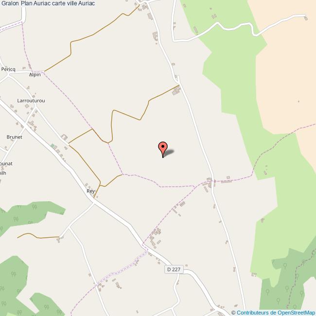
Auriac is located some 20 km north of Pau just east of Argelos. Access to the commune is by road D834 from Sarron in the north which passes through the commune and continues to Pau in the south. Access to the village is by road D944 from the village to Thèze in the north-west and the D227 from the village to Sévignacq in the south-east. The A55 autoroute passes through the north of the commune with Exit 9 just north-east of the commune giving access to road D834. The commune is mixed forest and farmland.
Places and hamlets
Neighbouring communes and villages
Toponymy
The commune name in béarnais is Auriac. Michel Grosclaude said that the name probably comes from the Latin man's name Aurius with the Gallo-Roman suffix -acum giving "Domain of Aurius".
The following table shows the origin of the commune name:
Sources:
- Raymond: Topographic Dictionary of the Department of Basses-Pyrenees, 1863, on the page numbers indicated in the table. (in French)
- Grosclaude: Toponymic Dictionary of communes, Béarn, 2006 (in French)
- Cassini: Cassini Map from 1750
Origins:
- Marca: Pierre de Marca, History of Béarn.
History
Paul Raymond noted that Auriac was once an annex of Argelos.
Administration
List of Successive Mayors
- Mayors from 1940
Inter-communality
The commune is part of five inter-communal structures:
- the Communauté de communes des Luys en Béarn;
- the SIVU for collective sanitation Auriac-Miossens-Lanusse-Thèze
- the Energy association of Pyrénées-Atlantiques;
- the inter-communal association for the management of drinking water from the Luy-Gabas-Lées;
- the inter-communal association of Garlède-Lalonquette;
Demography
The inhabitants of the commune are known as Auriacois or Auriacoises in French.
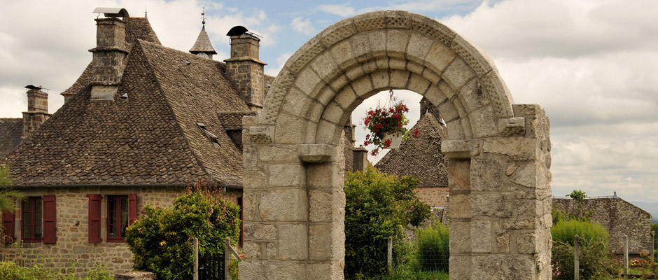
Culture and heritage
Civil heritage
The commune has a number of buildings and structures that are registered as historical monuments:
- A House at Porte (16th century)
- A House at Cazaudehore (19th century)
- Houses and Farms (16th and 19th centuries)
Religious heritage
The commune has two religious buildings that are registered as historical monuments:
- The Parish Church of Saint-François-de-Sales (18th century) (destroyed)
- The Parish Church of Saint-François-de-Sales (1885). This church was built in 1885 to replace the old church of the same name which appeared on the Cassini Map. The Church contains many items that are registered as historical objects:
- The furniture of the church
- A Chasuble (18th century)
- A Sun-ray Monstrance (19th century)
- 2 Altar Candlesticks (19th century)
- A Chalice (19th century)
- A Prie-dieu (19th century)
- A Stoup (19th century)
- 2 Altars, 4 altar seatings, and 2 Tabernacles (1885)
- An Altar, 2 altar seatings, a Tabernacle, and 2 Statues (1885)
- 3 Stained glass windows of people: Saint Francis de Sales, Saint Michael protecting a canon, and Saint John (1887)
Facilities
Auriac has a primary school which also serves the communes of Garlède-Mondebat, Lalonquette et Miossens-Lanusse in an Educational Inter-communal Grouping.
See also
- Communes of the Pyrénées-Atlantiques department
References
External links
- Community of communes of Luys en Béarn website (in French)
- Auriac on Géoportail, National Geographic Institute (IGN) website (in French)
- Auriac on the 1750 Cassini Map